


|
|
Below is an aerial photograph of Pebble Beach (including parts of Carmel and Pacific Grove), highlighting the area of the track. From this I could get a street map and start detailed measurements of the area. The sandy part near the top of the photo is the Spyglass Hill golf course. The baseball diamond and the oval running track near the upper-right corner belong to Stevenson high school. Just off the right edge of the photo you can see part of the Poppy Hills golf course. The collection of white buildings near the water at the bottom are The Lodge at Pebble Beach and some related buildings. The Links at Pebble Beach (i.e., the Pebble Beach golf course) can be seen surrounding these white buildings. The famous 18th hole is the dark green area on the water just below (south of) the Lodge. The scenic 17-Mile Drive (which is really 10.5 miles long) more or less follows the coastline through this entire photo.
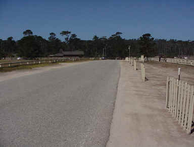
This photo is taken from the location of the start/finish line. The road rises here as the Pebble Beach equestrian center is on the right and the open parade grounds are on the left. Beyond the trees in the distance lies the Pacific Ocean.
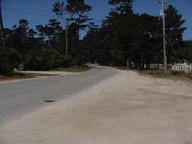
Shortly after the start/finish line the track makes a slight jog to the left, shown here. Just around this bend is Alva Lane, a short cross-street that intersects the track from the left.
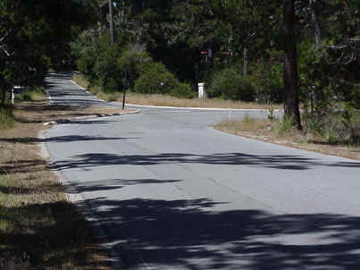
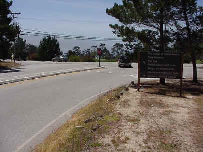
Here is the approach to Turn 1 in real life. As you can see, Portola Road continues straight ahead after the little "chicane." You can just see a hint of a house behind the trees outside of the corner. I don't believe the little island was there in the 1950s, which gave the road a much-needed run-off area.
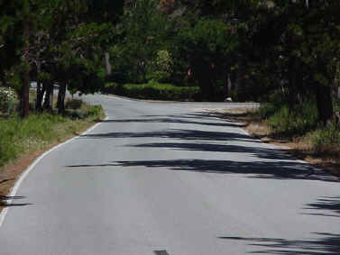
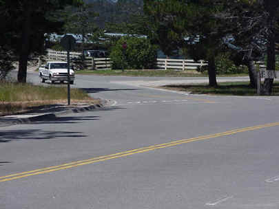
This is the approach to Turn 2, from Sombria Lane onto Drake Road. Sombria bends to the left after this corner, but of course, that's impossible to model in GPL. I tried to make the road continue onwards as best I could.
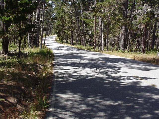
Here's part of the run down Drake Road, about halfway between T2 and T3. You're heading north at this point. The Cypress Hills golf course is through the trees on your left; the Pebble Beach Equestrian Center is through the trees on your right (infield). You can see how the road surface undulates and wiggles; this is modeled pretty well (IMHO) in the GPL track. Those trees look mighty menacing at 100 MPH.
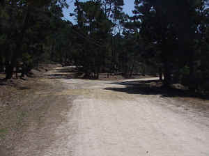
In the early days, the first running of the race used a shorter version of the track. Instead of turning left at T3 and right at T4 the cars drove straight ahead over this section of road. The gate in the distance prevents modern-day traffic from following the same course. As you can see, the road surface has deteriorated somewhat since 1950.
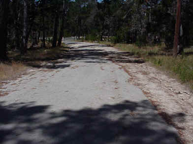
In the "modern" version of the track (1951 - 56), the road surface turned to dirt immediately after the T4 hairpin. It's still dirt to this day, as you can see here. In GPL, driving on dirt is too difficult to bother with, so I defined the track surface here as asphalt but used a different texture MIP to simulate the look of packed dirt. This picture was taken at the point where the dirt road forks, not yet at T5.
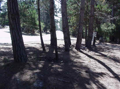
Here is where the longer track path joined the paved road again, at T5 and Forest Lake Drive. As you can see, some trees have grown across the former path of the racing cars. The 1950 "shortcut" also joined the paved road at exactly this point; the metal gate in the next photo is also barely visible near the right side of this picture.
Here at T5 is the other end of the 1950 "shortcut." The track exited here, through the gate, and turned right onto Forest Lake Drive. In the "modern" version (1951 - 56), this point is shortly after the T4 hairpin. Here begins the long straight downhill to the final corner, T6.
At the end of the long back straight comes the tight right-hander at T6. This is where Forest Lake Drive turns 90 degrees onto Stevenson Drive. In real life this is a four-way intersection. Ahead is the continuation of the road, although it changes its name to Ondulado Road. The Peter Hay par-3 golf course is here on the corner. Turning left takes you east (and somewhat uphill) into the rest of Pebble Beach. Turning right -- following the race course -- takes you onto Stevenson Drive, which has been extended considerably since the 1950 racing map was drawn. I left out the concrete center "island" seen in this photo. Whether it was really there or not in 1956, the thing is such a hazard that I decided to eliminate it.
Here comes the final bend before re-crossing the start/finish line. Stevenson Drive continues straight ahead, but we'll take the left-hand fork shown here onto Portola Road once again. The equestrian center can be seen coming up on the corner and the Pebble Beach Driving Range is immediately behind us.
That's it. Time for another lap!
|
|
Please e-mail comments, problems, rants, or raves to me: GPL {at} JimTurley
{dot} com. |
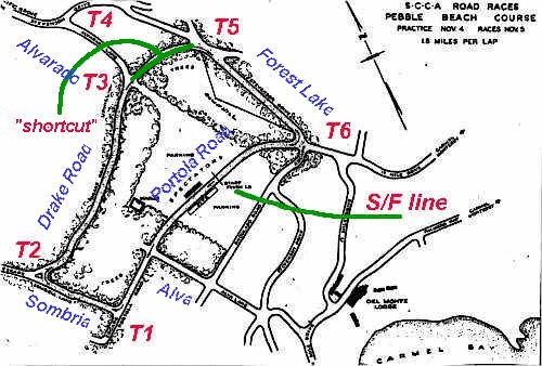 Here,
in its entirety, is all the documentation I had to work with to recreate
the Pebble Beach Road Race of the 1950's. It's exactly one grainy photocopy of a
hand-drawn map published in a book I can't identify. (The colored notations are
mine.) Based on this map I searched for the modern-day roads (some of which have
been renamed) and traced the route of the 1.8-mile course, which later became a 2.1-mile course.
Here,
in its entirety, is all the documentation I had to work with to recreate
the Pebble Beach Road Race of the 1950's. It's exactly one grainy photocopy of a
hand-drawn map published in a book I can't identify. (The colored notations are
mine.) Based on this map I searched for the modern-day roads (some of which have
been renamed) and traced the route of the 1.8-mile course, which later became a 2.1-mile course.